The Boundary Markers of the Original District of Columbia are the 40 milestones that mark the four lines forming the boundaries between the states of Maryland and Virginia and the square of 100 square miles (259 km²) of federal territory that became the District of Columbia in 1801. While abandoned long ago, these structures are actually our nations first perimeter marker.
The Residence Act of July 16, 1790, as amended March 3, 1791, authorized President George Washington to select a 100-square-mile site for the national capital on the Potomac River between Alexandria, Virginia, and Williamsport, Maryland.
President Washington selected the southernmost location within these limits, so that the capital would include all of present-day Old Town Alexandria, then one of the four busiest ports in the country. Acting on instructions from Secretary of State Thomas Jefferson, Major Andrew Ellicott began surveying the ten-mile square on February 12, 1791.
The stones had all but disappeared but were recovered by volunteers from the Maryland Society of Surveyors while working on a resurvey of the D.C. line. David R. Doyle of Silver Spring, Maryland, placed the marker in his garage in 1991. Just south of Washington DC in Arlington, A survey team in 1791 led by Major Andrew Ellicott placed these fenced in markers. A humbly sit 39 milestones that mark the four lines forming the boundaries between the states of Maryland and Virginia and the square of 100 square miles (259 km²) of federal territory that became the District of Columbia in 1801.
Before the surveyors stepped in, the relics of our nation's infant stage had been ignored and were largely unknown, even by those who live a few feet from them. No one has been quite sure what to do with them for more than 200 years.
Only one, the boundary stone in is a National Landmark. The other 39 are on the National Register of Historic Places, but receive no federal preservation money and no maintainence.
Some of the stones are all but gone, some have been moved to accommodate road and building construction and others have been stolen or lost, according to the Nation’s Capital Boundary Stones Committee’s Boundarystones.org site. All 10 stones within Arlington’s limits are authentic originals. They are at the following locations:
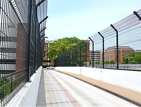
- North side of Walter Reed Parkway 100+ feet east of intersection with King Street. Only the stump of this stone remains. Its current condition is consistent with Woodward's 1908 report that the "stone is broken, and the top seems to be lost. The entire base, with a few inches of the finished portion, was found lying on the ground in approximately the same spot where it had originally been placed." This stone is now nearly 45 feet from its original position and is enclosed by wrought iron fencing structures that protect and preserve them. 5000 block, Old Dominion Drive (private residence)
- 3000 block, N. Powhatan Street (private residence)Andrew Ellicott Park, 2824 N. Arizona Street
- Benjamin Banneker Park, 1701 N. Van Buren Street
- In the parking lot of Patrick Henry Apartments Complex, the 6000 block of Wilson Blvd
- Carlin Springs Elementary School parking lot
- The median on the 1000 block of S. Jefferson Street
- The north side of the 2700 block of S. Walter Reed Drive
- Fairlington Village, King Street, between S. Wakefield Street and I-395
Four of the forty original boundary markers were not in or near their original locations in 2006. Three of these had been replaced with protective gate markers. Below, summaries of some of the most intriguing stones and their current locations.
Southwest No. 2 Boundary Marker
7 Russell Road: east side of Russell Road just north of King Street. This is neither the original stone nor the original location. Baker and Woodward reported the original stone to be missing as of the late 1800s, and DAR records show that the current stone was placed at this location in 1920. The original stone was located about 0.35 northwest of this replacement. According to Woodward, the original "stone was evidently placed on the east side, and very close to, [King Street], on the eastern side of Shuter's Hill, in a subdivision" now called Rosemont.